
For the past ten years, Christchurch and surrounding areas have continued to experience on-going seismic activity. Sometimes the quakes aren't widely felt, others are short sharp jolts that see Twitter and Facebook light up. The severity of ground shaking during an earthquake, as it's related to specific building locations and the structure of those buildings, can have an impact on the safety of those buildings and whether they should be occupied or not.
After a recent small quake on 10 March 2020, we decided to share the ground shaking measurements recorded by Sentinel and how that compared to GeoNet’s reported “felt shaking” results.
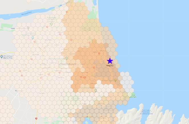
The quake itself was Magnitude 3.2, 9km deep and was centred pretty much directly under the South New Brighton campground. GeoNet reported light ground shaking that was felt across much of Christchurch.
What was Sentinel's response?
Variability in shaking
There was significant variability in measured shaking across the city. If people felt it, they were mostly indoors - few reported feeling the quake if they were outside. Dishes, windows and doors were disturbed. For many others, the quake went un-noticed.
Pattern
The pattern of shaking distribution was not even. There were higher shaking levels in the softer soils to the west and north of the epicentre (toward the city), but also along the ridgeline of the hard rock of the Peninsula. There were large areas of weaker shaking around the base of the Port Hills, and toward the west
Buildings
Some buildings (especially in the soft soils to the north and west of New Brighton) will have approached the point at which some non-structural damage might be expected (broken crockery, plaster damage, etc.).
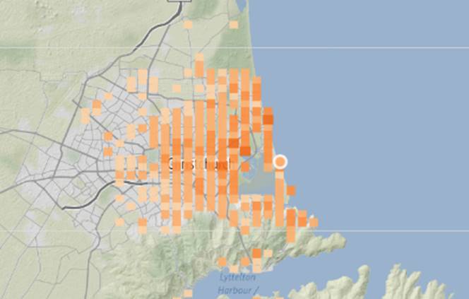
What this is telling us is that people’s perception of what they felt does not correlate well with what was actually measured. Compare the GeoNet perceived felt report map with the Sentinel shaking intensity map (measured by Sentinel sensors). The felt report map shows a wider level of variation (with many people reporting “moderate” shaking and a few reporting “strong”), and a wider spread across the city with little observable pattern.
GeoNet Map (reported by people based on their perception)
Sentinel Map (measured by Sentinel sensors)

So what can we take away from this? Simply that earthquake effects are best managed on the basis of local measured information. What was an unnoticeable event for most people may have caused damage for others. Relying on your own or other people’s perception of what was felt is not accurate or safe.
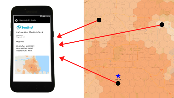
If you have to make decisions about your building or your business, having the Sentinel solution in place enables you to do so quickly. It directly measures ground shaking at hundreds of points. It then instantly compares the point-by-point shaking to every individual building’s design limits using best-practice and well-proven spectral analysis techniques.
If the lessons of the past have taught us anything - especially the recent past - it's that earthquakes are unpredictable, meaning people and businesses need to be prepared, and have the necessary information to make safe, fast decisions.
Are you responsible for your people’s safety and your organisation’s continuity? Sentinel is the technology that ensures you make the right call when an earthquake happens. Contact us now to find out more.
SHARE